
 Discover the starriest spots in England, and the areas most blighted by light pollution, in our satellite maps of the country’s night skies – the most detailed and accurate ever produced.
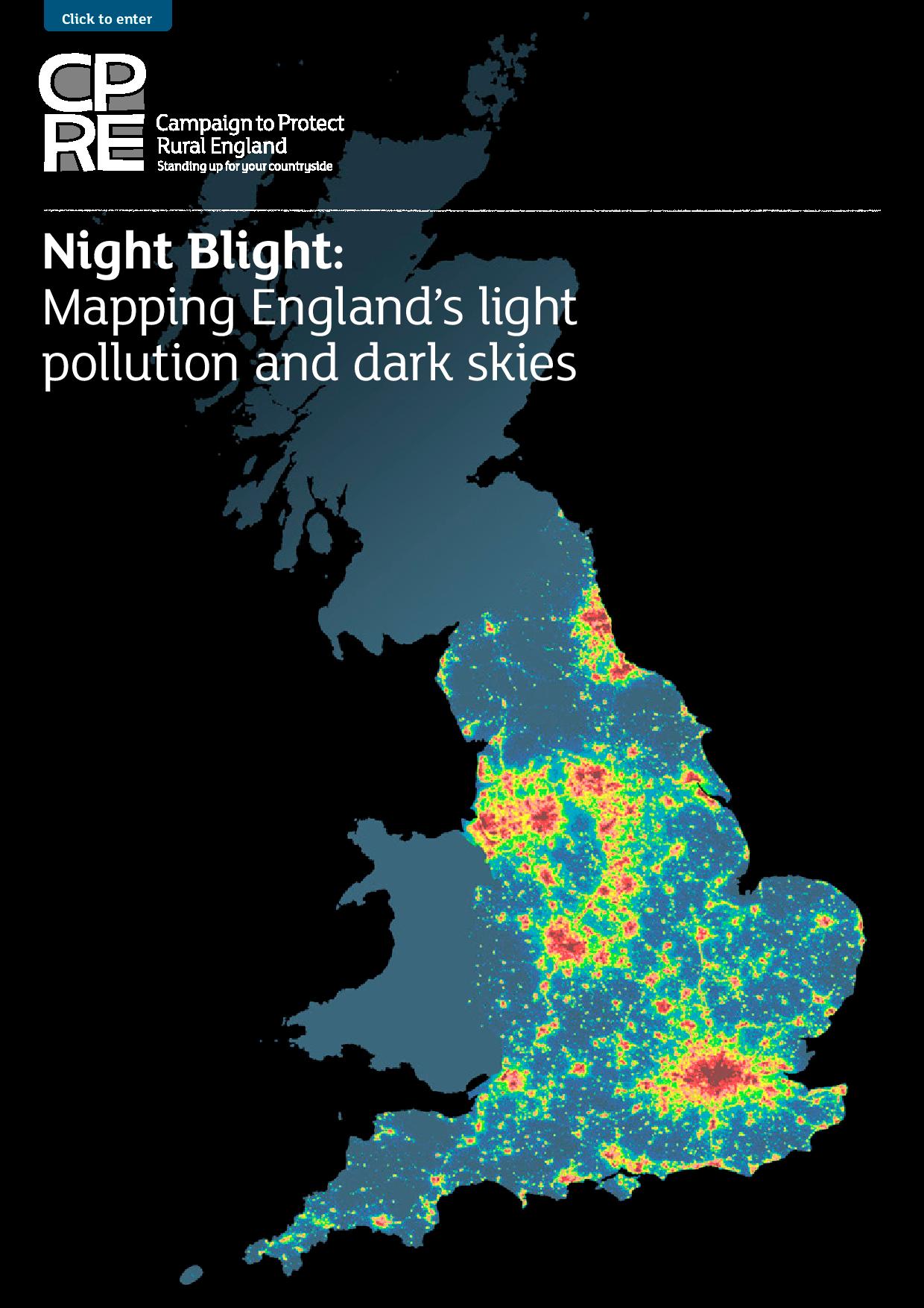
The landmark maps, produced for CPRE by consultants LUC, show that the Isles of Scilly, west Devon and Eden in Cumbria are the country’s darkest districts. A remote hillside on Kielder Moors in Northumberland was the darkest spot. Northumberland was also the county with the highest proportion of pristine dark skies (72%), although on average Herefordshire was the darkest county overall.
Nationwide, the maps show that just 22% of England is untouched by light pollution, with major roads a significant source of the problem.
Astronomer Royal, Sir Martin Rees, welcomed the ‘fascinating’ maps.
“They tell us where dark skies can be found – and perhaps, by highlighting the regions where light pollution is greatest, will encourage remedial efforts that will not only save energy, but also enable more of us to enjoy a dark sky in the way earlier generations could,” he said.
Meanwhile, there was good news for the South Downs this summer, with the National Park receiving official international Dark Skies Reserve status.
See the maps here and download our Night Blight report.
